
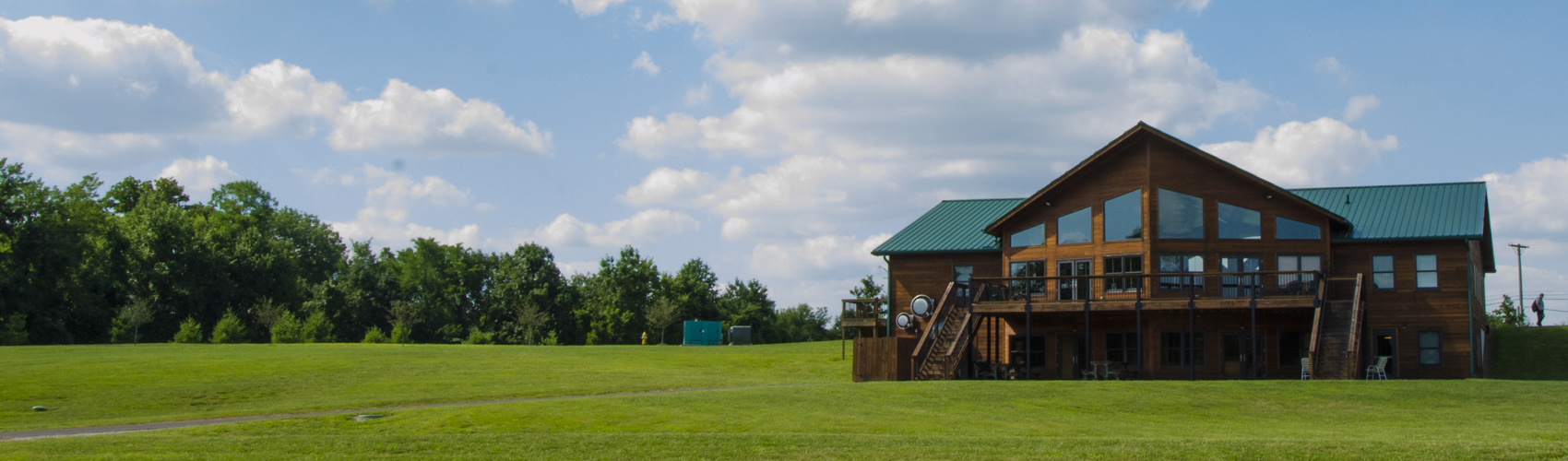
Emerald Hills is Team Expansion’s “home base” campus in Louisville, Kentucky. Although we’re not much for military analogies, at least one missions pastor has referred to it as “the Fort Benning for a new wave of global missionaries.” In a way, he’s right — it serves as a center for global prayer, a training base for new workers wanting to change the world, and a retreat for returning missionaries who need to retool or even recover from tough times in difficult lands.
To learn more about how you might help empower the final few dollars of construction costs for this first phase of the campus, just visit ReachingTheUnreached.com.
But perhaps, today, all you want to do is get a feel for what it would be like to pray at Emerald Hills. Or, alternatively, maybe you’re going to visit Emerald Hills and you’re wondering where you might prayer-walk while you’re here. Well here are some instructions explaining how you can do a “virtual prayer walk” without ever having to leave your own living room — or prayer-walk on a real trail when visiting.
- First, please download the app, AllTrails to your smartphone or tablet. You should be able to find it wherever you normally go to download apps.
- Second, create an account. It’s free. There’s no need whatsoever to purchase a pro account. Just use the free option and “X” out of the pro promotion.
- Third, choose which trail you’d like to walk. Each of the 4 trails begins under the canopy out in front of the Prayer Center and Atrium.
- The Great Lawn Loop (Accessible for wheelchair users) — Length: 1/3 mile. Elevation gain: 7 feet.
- After installing AllTrails on your smartphone or tablet, click here.
- The North Woods Passage — Length: 3/4 mile. Elevation gain: 46 feet.
- After installing AllTrails on your smartphone or tablet, click here.
- Tulip Tree Grove Trail — Length: 1 mile. Elevation gain: 82 feet.
- After installing AllTrails on your smartphone or tablet, click here.
- Tall Timber Forest Trail — Length: 1.5 miles. Elevation gain: 102 feet.
- After installing AllTrails on your smartphone or tablet, click here.
- The Great Lawn Loop (Accessible for wheelchair users) — Length: 1/3 mile. Elevation gain: 7 feet.
- Fourth, when the activity opens in AllTrails, scroll down and use the “enlarge” (pinch) gesture to enlarge the map a bit. Now, as you walk (beginning in front of the Prayer Center and Atrium), the “blue dot” that represents your position will follow the path on the map. If you take a wrong turn, you’ll see your blue dot veer off the map – so it will act as a constant reminder to help you stay on the pre-marked trail. Also, when you approach stationary dots on the trail, that’s your queue to click on the dot – and the next picture in the photos below the map. (Note: Sometimes, you might have to try a time or two to make sure you’re clicking on the correct picture for your current location.) Below the photo, you’ll find a brief caption/prompt that provides a brief prayer request to go along with the photo. (Note: You might need to press the “more” button to see the entire caption.) After you pray through a couple of the captions, we hope you’ll get the hang of it. (Note: We don’t list the activity/map in the AllTrails “Public Listing” because we really aren’t set up to raise the lift arm for a lot of tourists who just want to hike our trails without praying. haha So this is kind of like a private use of the AllTrails app.) If all goes well, your prayer walk should begin and end at the same point (immediately adjacent to the canopy in front of the Prayer Center and Atrium).
- Note: To help cast the vision for these prayer walks, and also to help those who, for whatever reason, can’t come in person, we’ve prepared this virtual prayer walk from the Great Lawn Loop. We’ll add videos from other, additional trails soon: